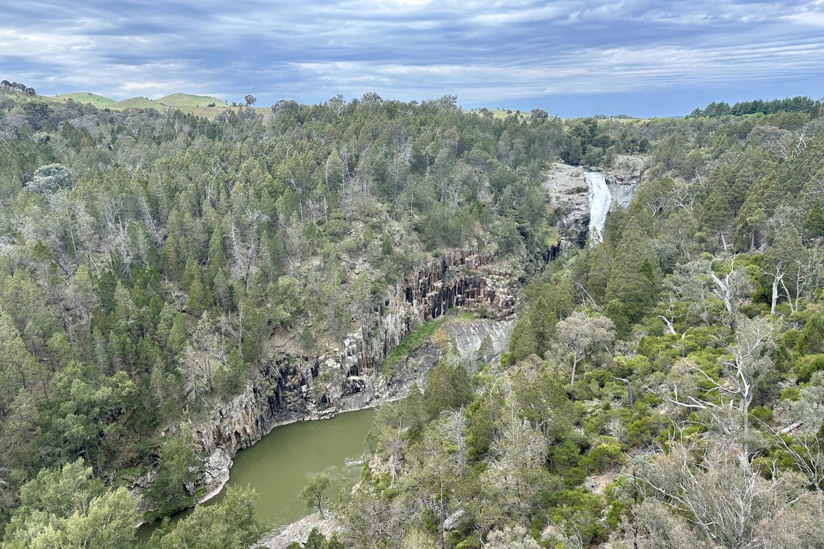
Ginninderra Falls: A Longstanding History
Ginninderry is a Joint Venture between the ACT Government’s Suburban Land Agency and Riverview Developments, with Riverview Projects acting as Development Manager.
The concept of Ginninderry, Canberra’s only 6-Star Green Star Community, was first raised with the ACT Government and Yass Valley Council in 2006. The Ginninderry Project has a longstanding relationship with the region and a strong understanding of the landscape, with Ginninderra Falls holding substantial First Nations and European cultural and ecological significance.
The Ginninderry project site includes land in both the ACT and NSW; the bulk of the land is controlled by the Ginninderry Joint Venture (GJV) with the exception of two parcels in NSW, one of which adjoins and provides access to Ginninderra Falls. All of the land, including the Ginninderra Falls and Gorge, was included in the Ginninderry masterplan and subsequent rezoning.
Following consultation with Aboriginal groups and individuals, in 2017, Ginninderry commissioned Waters Consulting to consult with local First Nations knowledge holders to develop a Cultural Values Assessment Report. The report highlighted the following in relation to Ginninderra Falls:
All of the knowledge holders identified the Project Area as being located within a culturally significant landscape with the lower Ginninderra Creek area in particular being regarded as holding a high degree of cultural significance. Two of the eight knowledge holders stated that while they were aware of the Ginninderra Creek area and of the Ginninderra Falls in particular as a culturally significant area, they did not have any specific site knowledge.
The report also recommended an expansion of the proposed area at Ginninderry to be set aside for conservation in the vicinity of the Falls and in another area on the Murrumbidgee River that was identified as significant. This is now reflected in the Yass Valley Local Environmental Plan (Parkwood) 2020 zone boundaries, with the conservation area being zoned C2 – Environmental Conservation.
With a lens to European settlement history, Ginninderry commissioned Dr. Mary Hutchinson to develop a study titled ‘Stories and Histories of Non-Indigenous Ginninderry People and Places’. This research outlined that Thomas Southwell arrived in the Ginninderra district in 1840 and worked as a farmer and carrier. In 1854, he bought land at the junction of Ginninderra Creek and Murrumbidgee from owner Alick Osborne and named it Parkwood. James Kilby acquired Crown land overlooking the junction of Ginninderra Creek and the Murrumbidgee next to Thomas Southwell’s Parkwood. The land included Ginninderra Falls, and he named his property ‘The Falls’. In 1897, he married Thomas Southwell’s daughter Beatrice. In 1910, James bought Parkwood, and the two properties became one. After Federation in 1901, land was granted by New South Wales for the new capital of Australia. Surveying of the borders commenced in 1910, and the “straight line” between existing trig points at Mt Coree and One Tree Hill was determined. The straight line between the trig points cuts through the natural peninsula of land bordered by the Murrumbidgee River and Ginninderra Creek. It is believed that Ginninderra Falls opened to the public with trails, picnic facilities and other amenities in 1979, with public access remaining until 2004. At this point, reportedly, public access became non-viable following public liability concerns and the site was closed to the public.
In more contemporary times, the Ginninderra Falls and Gorge have attracted much community interest. So much so that an organisation – the Ginninderra Falls Association (GFA) – was incorporated in 2012 by several interested individuals primarily located in Belconnen to have the Ginninderra Falls, Gorge and a large surrounding area dedicated as a national park.
A request was made by the GFA to the NSW Government in 2012 to investigate the possibility of establishing a national park. Following their investigation of this proposal, the NSW Office of Environment and Heritage responded that the land was not suitable for use as a national park but did have conservation value and suggested other avenues for preserving these values. This position complemented the GJV’s vision for Ginninderra Falls and its long-held view that the Capital Region community should have safe access to Ginninderra Falls from Parkwood Road.
Riverview’s commitment to this position included funding and taking the lead on the rezoning of land at Parkwood, including Lot 61 (containing the Ginninderra Falls and Gorge). The rezoning occurred in 2020 with the agreement of the landowner of Lot 61. The rezoning was approved by the NSW Minister for Planning and Yass Valley Council in 2020. All the land identified for the future Ginninderry conservation corridor was rezoned to “C2 – Environmental Conservation”; this provides a very high degree of protection for the cultural and environmental values, and precludes any development.
The balance of the land was rezoned for residential use (“R1”) with a small parcel zoned “SP1 – resort, retail & tourism” to allow for, amongst other uses, the development of a community facility, restaurant or café, eco-tourist facilities, information and education facilities adjacent to (but outside) the C2 zoned conservation area.
As the rezoning process demonstrates, the GJV has considered all privately owned NSW land as part of its masterplan, with the cooperation of all the owners; however, it has always done so knowing that the ultimate treatment of the land would be subject to the individual owners. Two of the four parcels have been acquired by the GJV. A 55 hectare portion of Lot 61 (total area of 80 hectares), one of the remaining two parcels, is now listed for sale via an Expression of Interest process announced on 15 October 2024.
With the property now on the market, it is understood that Riverview Developments is taking the appropriate steps to assess the opportunity. Importantly, regardless of the individual, family, organisation or collective that owns the Ginninderra Falls and its surrounds in the future, the GJV looks forward to seeing the C2 (Environmental Conservation) land dedicated to conservation efforts and Ginninderra Falls public access return.


